 |
| 9,461foot Miller Peak. |
I first hiked Miller Peak from Montezuma Pass in 2018 as part of my training to hike down into the Grand Canyon (a story in three parts: South Kaibab, Phantom Ranch, and Bright Angel) with my good friend Ira. I also hiked it December, 2015, from the Ramsey Canyon trailhead, a longer hike of around 12 miles.
Started the hike at the Coronado National Monument visitor center parking lot. Funny because the cars in the lot at 8:00 am were from, in order, Illinois, Minnesota, Nebraska, and Iowa. Apparently I'm not alone on my snow bird hiking obsession.
Joe's Canyon Trail begins with some serious climbing via switchbacks cut into the granite hills. The elevation is mostly front-loaded because after a mile-and-a-half of pulse-raising climbing, you're treated to a beautiful savannah ridge trail overlooking Mexico to the south, and the peaks of the Huachucas to the north. The ridge trail takes you first to the Yaqui Trail, part of the 800-mile Arizona Trail, which takes you down to the border with Mexico. I have hiked that on numerous occasions, usually as a side trip in conjunction with the Joe's Canyon hike. It's fun to climb through the barbed wire fence and mock the scurrying Border Patrol agents from the Mexican side. After the Yaqui Trail, it's another .7 miles to the turn-around point for this hike, Coronado Peak and Montezuma Pass. And Montezuma Pass is the start point for the Miller Peak hike up the Crest Trail, itself part of the Arizona Trail.
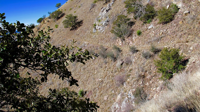
The Crest Trail wastes no time climbing. Switchbacks take you up the southern side of the foothills in Miller Peak Wilderness, reaching a middling elevation of around 8,000 feet, up from 6,500 feet at the pass, in about 2 miles. Then it's a few miles of gentle climb until the much steeper spur to the top of Miller.
Windy and chilly at the top and no other hikers until I run into a young solo hiker on my descent. There was also snow and ice on top, to be expected this time of year, but I donned my Kahtoola micro spikes and and made it through the worst of it in fine order. The trip down was much easier and I was back at the car in about three hours, almost 1 ½ hours fewer than the climb up.
 |
| Miller Peak as seen from Hwy. 92. Carr Peak is the other summit, to the right. |
 |
| Miller is to the right, much further away than the hill in the foreground. |
 |
| Beautiful start to this hike, as per usual. |
 |
| The ridge takes you all the way to Montezuma Pass, center-right. |
 |
| Looking south to the mountains of Mexico. |
 |
| Montezuma Pass. |
 |
| The Crest Trail is also part of the Arizona Trail, which if followed would take you to the Utah border, almost 800 miles in its circuitousness. |
 |
 |
| A stark reminder of the fires which swept through the Coronado Wilderness several years ago. |
 |
| My heart really sank when I found out I had to leave my hang glider behind. |
 |
| About 2 ½ miles to go. |
 |
| Looking east southeast. |
 |
| Most of the snow was concentrated in the last ⅓ mile. |
 |
| Looking east toward Bisbee. |
 |
| Looking west, toward Tucson. |


No comments:
Post a Comment