It’s my final day on the canyon floor before I begin my two-day climb up the Bright Angel Trail and out. Today is a short day, five miles and 1,300 feet of elevation gain, with most of that concentrated in a section called Devil’s Corkscrew. Devil and screw sound pretty ominous, but I’ll keep an open mind. Plus, my 40-pound pack is now down around 35 pounds, so feeling light. I also feel like I feel on day five on a bike tour: way stronger than when I started. It is going to be a scorcher today, but I trust the higher elevation and shade in Indian Garden will keep things a little bearable.
With such a short day, I am also planning to catch a sunset at Plateau Point this evening, a short, flat three-mile out-and-back from Indian Garden Campground. I’ve heard it’s spectacular, unearthly. But that can be said of most of the Grand Canyon.
Indian Garden is so-called because it was used seasonally for centuries by ancestral Pueblans, Cohoninas, and Havasupai, who were attracted to the perennial springs of this little oasis, and the relatively flat land of the Tonto Plateau that lent itself to farming. Indian Garden provided a summer respite from the heat, with tall shady cottonwood and aspen groves, and a big, broad plain to grow food for the winter. They made their way to and from the South Rim via a nascent Bright Angel trail, probably using ladders to traverse the steep, rocky outcroppings. The Havasupai were still farming in 1910, but after Teddy Roosevelt declared Grand Canyon a national monument, they left and were probably forced out, to make way for tourists like me.
 |
My neighbor offers to take my picture as I was heading out. Looking really good here with my 5-day stubble and dirt-tinged shirt.
|
 |
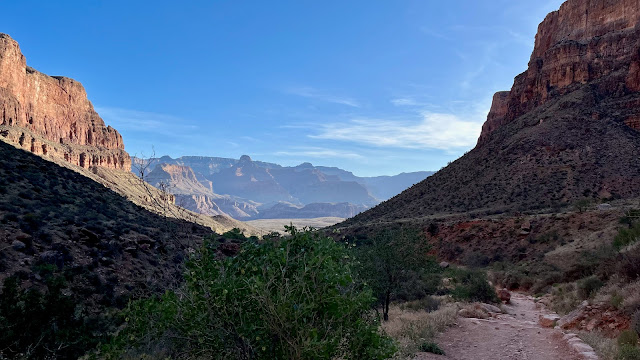
Normally one would say, wow, what a beautiful sunny morning, but what I wouldn't do for overcast. But yeah, beautiful.
|
 |
| One shouldn't anthropomorphize other animals, but these folk don't look too stoked to be here. |
I leave Bright Angel about 6:15 and set a pretty good pace and would make it to Indian Garden in just over two hours. I seem to be getting more fit every day, my knee and arm have scabbed over nicely and I never think about them. And the bruises I developed on my shoulders from my pack have faded and been replaced with muscle. As I head toward the Silver Bridge across the Colorado, I pass by the burro corral and can’t help but feel for the poor beasts tied up and waiting for their next load of primates, supplies, or trash. Surely they can’t enjoy their days toiling up and down these trails. I’m sure the park service will defend their use, enabling as they do those who might not otherwise be able to make it into the Canyon on their own. And of course the handlers will always rationalize it by saying that is what they were bred to do. And that is certainly true: a mule is a one-off sterile result of interbreeding species. Of course, the National Park Service doesn’t have a history of the kinds of horse and mule abuse meted out by the Havasupai tribe at Havasupai Falls that helped shine a light on pack animal abuse in the first place. That said, perhaps we should consider the mules more than the humans when weighing the pros and cons of burro rides.
 |
| The Silver Bridge is a 500-foot suspension built in the late 1960s. It connects the North Kaibab Trail on the north side of the Colorado River, to the Bright Angel Trail on the south. |
 |
I was glad to see no one approaching from the south as there is little room for maneuvering around another hiker carrying a big F.O. back pack.
|
 |
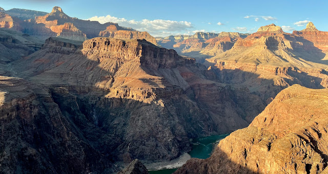
View of the once mighty Colorado river, emasculated in the 1960s by the Glen Canyon Dam, which cut the flow through the Grand Canyon to a relative trickle, changed the riparian flora and fauna, and slowed to a crawl the hydraulic erosion of the rocks in the stream bed and the canyon walls. The reservoir formed behind the dam, Lake Powell, which took 17 years to fill inundated a canyon of immense beauty and destroyed an ecosystem and for what? Why to provide boat recreation and water to an already overpopulated desert, in a climate that can't support a hundredth of the current population of Homo "so-called" sapiens. Ironically, climate change has shrunk Lake Powell to the level in was in 1963 when it was first being filled. Soon, it will disappear completely. Or let's hope so.
|
 |
It's hard to see from the picture, but this trail is covered in wind-blown soil and sand, mini dunes really, which, while very cushy, is not a great footbed for backpacking. Waah.
|
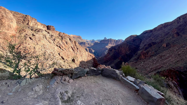
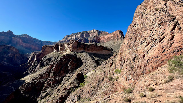
The first half mile after crossing the Silver Bridge was like hiking in the Kalahari, with deep, slippery almost quaggy sand underfoot. Not ideal, but I had absolutely nothing else to bitch about because I was walking on the flats. Much of the elevation gain is coming up at the Devil’s Corkscrew set of switchbacks in a mile or so.
I catch up to a group of young backpackers near the top of the ‘Screw, which I didn’t find terribly challenging. This was a group of six kids (late thirties and full-ass adults, actually) who had just landed from their six-day oar trip down the Colorado and were now hiking out. These self-propelled adventurers tend to be self-limiting and younger, sifting out those who can abide the noise of motors and the cacophony of 20 fellow travelers. They prefer not to have their idyllic vacation disturbed by screaming motors and gasoline fumes.
 |
Smiling in earnest.
|
This young woman asked to take my picture, which I obliged and also returned the favor. Every one of these young river rafters raved about their trip, even the spindly thirty-year-old taking up the rear and struggling with his pack. They all wanted to do the trip again, maybe even opting for the optional 18-day tour. I might have to try it myself.
 |
Pole-resting break.
|
 |
Getting near the campground. I approached from the right, which points to the Colorado River.
|
 |
| Tonight just before dusk, I plan to take the Plateau Point Trail out to Plateau Point to catch the sunset. That hike will get its own blog entry as this post is already overladen. I wish the editor would just do his job. |
I arrived at Indian Garden about 8:30 and pick out the shadiest spot I can find. The young couple in the adjacent site are from Lawrence, Kansas, she wearing an NCAA champions t-shirt, of course. They are packing up and leaving a day early because some animal got into their food storage box during the night and ate their lunch and dinner. They told me the they saw a pink rattlesnake previous day lolling in my camp site. I thought that was pretty cool and really hoped it would return. Apparently, Indian Garden is rife with these The snakes evolved a pink hue due to their pink surroundings, the Redwall limestone prevalent at this altitude.
From the National Park Service (NPS) Grand Canyon website
Grand Canyon Rattlesnake Crotalus oreganus abyssus Often described as pink in color, this species is found nowhere in the world but the Grand Canyon. Commonly observed from Lees Ferry to the vicinity of National Canyon, primarily below the rim.
I pitched my tent despite (or because of) the snake sighting and because of the deep shade. Then, 30 minutes later, stupidly moved to an adjacent site because of its incredible surrounding backdrop, and then moved again back to the shade as the sun rose, and as detour-directed hikers from the main trail (see helicopter story below) obliviously traipse through my site in a steady stream. But mostly it was the disappearing shade of this otherwise drop-dead gorgeous campsite. I have really become sun-averse, and my chronic squamous cell carcinoma will back me up on that. So I move back to the shade just in time before a backpacker duo arrive who would have surely taken this most-coveted and shaded spot.
From NPS Grand Canyon Website
The Grand Canyon rattlesnake (C. oreganus abyssus) is a subspecies of the more broadly spread Western rattlesnake (Crotalus oreganus). Blending into Grand Canyon's varied rock layers, this venomous pit viper uses its rattle to warn predators off, the tiny muscles firing up to fifty times per second--some of the fastest known to science. Take a "Minute Out In It" to appreciate the power of a zoom lens, since our ranger knew to keep a very safe distance from the hemotoxic venom of this coiled carnivore.
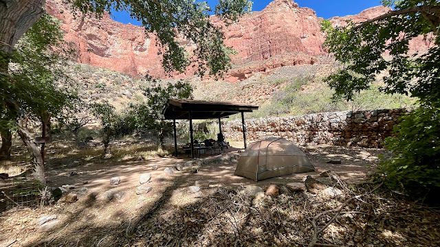
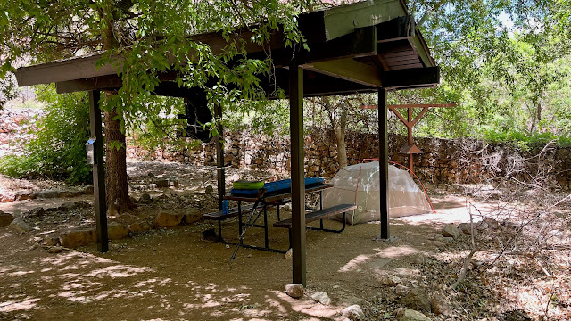
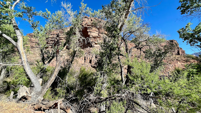
But one can't really miss at any of these sites. This campground is really deluxe. Besides the plethora of trees and shade, each site also sported a ramada, itself great for shade, and also as protection from those rains that come in the monsoon season.
 |
The site I temporarily moved to simply because it was real perty. But the arc of the sun took much of the shade away so 30 minutes after I moved I moved right back. My tent is free standing, however, so I just picked it up in toto and moved it.
|
 |
I made the right choice on this site, twice.
|
 |
Water (stone cube), conveniently located a few paces from my tent.
|
 |
My own campsite backdrop ain't too shabby.
|
After I settled in to my shady camp site, a couple of fifty- (or sixty-something, I can’t tell anymore) backpackers arrive to replace the Kansans who had since departed for the Rim. They are obviously good friends as I could hear them good-naturedly flipping each other shit and generally joking around. I asked where they were from and my ears perked up when they said Pensacola. I spent a year in school at NTTC Corry Station in Pensacola after I finished Naval boot camp in San Diego in the late 70s. I was attending the naval intelligence school, to learn cryptology and electronic intelligence. They had hiked down the South Kaibab and are hiking out tomorrow, as am I.
Juan Fraga was born in Cuba before moving to Florida as a baby. Juan spent 12 years in the Navy as an air traffic controller and now works as a technical consultant. He served on the U.S.S. Enterprise, and the Midway, which is now a museum in San Diego. Richard Loza retired after serving 20 years as a medic, working first for the Marine Corp, and finally as an instructor at Corry Station. Juan and Richard are both Marlins fans and also support the Marlins local AA team, the Blue Wahoos. Juan, tells me his hiker name is Falls Like a Pro, because of his propensity for catching himself with his poles when heading for the ground. Richard also has a hiker name, Earthquake, because of a time when his camp cot folded in two while he was sleeping and he dreamed he was experiencing a tremor. Juan is quite the quick wit, and Richard can also hold his own repartee. This is Juan's second big trip backpacking in the Grand Canyon. Several years earlier he and his daughter backpacked from the North Rim to the South Rim. They are both really sweet guys and I don’t think they’d mind me saying so.
 |
Juan "Falls-Like-A-Pro" Fraga (left) and Richard "Earthquake" Loza.
|
At one point just after noon, a helicopter makes a noisy appearance above the main trail. I see a litter (stretcher) attachment and assume it is an air ambulance. I asked a passing ranger if that were the case and she said that no, the company that built and maintains the toilets, Phoenix Composting Toilets out of Whitefish, Montana, was here for the annual collection of blue composting barrels. But the attached litter was standard on all helicopters, even those used to pick up poo; apparently, they pull double duty.
The barrels are wrapped in a thick cargo net three at a time and then picked up by a sky hook on a cable dropped from the helicopter. There are twelve barrels all told, and the helicopter would make three more trips to pick up barrels. This procedure also explains why the main trail traffic was routed through the campground for an hour-and-a-half and I was relieved to hear that hiker traffic was temporary.
And of course, as one would expect, after they hauled away the barrels from the main trail toilet, they turned their attention to our campground toilet, which also had twelve full compost barrels. We were told we could stay in our sites, but that would turn out to be a big a mistake, as we were to find out shortly when we experienced our own little helicopter shit-show.
Helicopter arriving.
Dust bowl that filled our lungs and gave me a week's worth of Covid-like symptoms.
 |
A ranger attaching the sky hook to the cargo net holding three compost barrels.
|
Blue barrels ascending...
...and being hauled up to the awaiting truck on the South Rim. The Phoenix blurb about this composting system on the wall of the toilet said this compost was organic garden-ready. Pretty impressive.
After the first dust storm, Juan, Richard and I decide to head over to the Amphitheater where an eager young ranger, Ranger Rebecca, was about to give her four o'clock presentation on Canyon safety. Rebecca obviously loved her job and it showed. She reminded me of many a first-year teacher, over worked and under payed, working in a job increasingly disrespectedt but buoyed nevertheless because of her personal joy in helping others, but unlike in teaching, working in a place that was its own reward.
Rebecca extolling this place so many peoples have considered sacred. And doing it with alacrity and zeal.
 |
| The amphitheater lies just behind the stone wall. |
After a dinner of Hatch Chile Mac and Cheese (which didn't disappoint), I headed out on my sunset hike to Plateau Point.
(To be continued...)
.jpeg)





.jpeg)
