Friday, January 31, 2025

Bren Peak Via The David Yetman Trail


I love the David Yetman Trail, a decidedly easy & relaxing 12.5 mile out-and-back in the wonderful Tucson Mountain Park. I most recently hiked it last January. The only aspect of the hike I've found lacking is the minimal elevation gain. Today I remedied that by adding a little 2.5 mile loop around Bren Mountain, with a side trip to the summit. I also lopped off the final mile to and from the Gate's Pass parking lot for a cool 14 miles, and a more respectable 2,000 feet of gain—700 of which was the 0.6 mile vertical scramble to the tippy-top.

And at the tippy-top, who did I meet but a fellow Iowan and her hiking pal, now both living in Arizona: Debbie from Iowa and Ken from Connecticut. They are both obviously strong hikers and from what Debbie said Ken, like me, has a penchant for long hikes.

Beautiful weather today. I waited later than normal to start (~10:30 am) as it was a bit too chilly at 8:00. Clear skies all day, with temps topping out at 65º by hike's end shortly after 3:30.


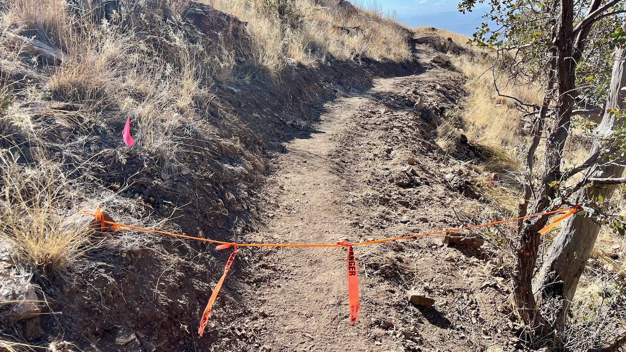
The trail starts out a little rocky, but soon gives way to undulating gravel and packed dirt. 


The historic Bowen House. This is only a mile in from the eastern trailhead, and is usually clogged with bipeds snapping pics, especially on weekends. Today I just slid past.


A mini Teddy Bear Cholla forest. Don't let these cuties fool you; get too close and they might end up attacking.


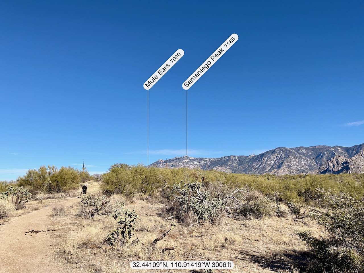
Lots of Saguaros as Tucson Mountain Park also resides in Saguaro National Park West.


The Bren summit, and Ken signing the book. The actual peak is right next door across a slight saddle, so of course we had to add that to the hike before descending, Deb and Ken clockwise and me counter-clockwise so as to get in my loop.


Debbie from Des Moines (Urbandale).


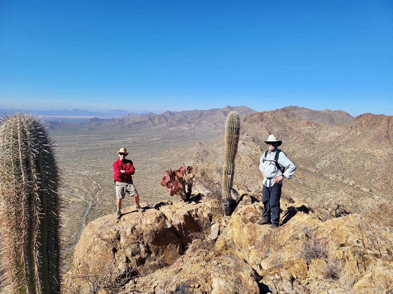
(Photo by Debbie)
Ken loves stepping out on precipices; me not so much. 


Debbie at the first summit.


Gate's Pass Road.


(Photo by Ken and his tripod and remote)

Monday, January 27, 2025

Pontatoc Canyon-Finger Rock Loop (Warning: Unofficial)


I have read two or three AllTrails hike descriptions mentioning a possible new trail connecting Pontatoc Canyon and the Finger Rock Trail, converging at Linda Vista Saddle, making a 7.4-mile loop, with serious elevation gain. And about three weeks ago on a hike up the Finger Rock Trail to Linda Vista Saddle, I saw what looked like a new trail being constructed just below where the spur trail from Finger Rock wends its way 0.2 miles up to the Saddle. 

Today, I can confirm that there is indeed a new trail being built connecting the two hikes, but it is being built center out and it might be a while before it is officially ready to hike. This new trail is no where near the terminus of the Pontatoc Canyon Trail and so we basically had to bushwhack our way up and over to it. The warning sign above we only saw at the end, where the trail meets the Linda Vista Saddle spur trail. We really had no business on this new trail, but it was just too tempting a hike. I was also excited that there was a new loop trail being built connecting with the underwhelming Pontatoc Canyon Trail, thus giving one more of reason to hike it; it currently ends abruptly facing a unremarkable cliff wall. 

Looks like that hope may not come true as this new trail appears to be headed to a point closer to the Pontatoc Canyon-Pontatoc Ridge trailhead than the Pontatoc Canyon Trail terminus. In any event, if the forest service continues to get money from the inept and cruel dolts in the criminally insane dotard’s administration, and this trail continues to be built, many hikers will rejoice that there is an alternative way other than the treacherous Finger Rock Trail up to and down from Linda Vista Saddle, and a somewhat safer route to Mount Kimball and other ridge-line destinations.

The elevation gain is nothing to sneeze at, and almost 300 feet 
more than the challenging Finger Rock ascent to the Saddle. The 
pace was so slow because of all the bushwhacking on the steep 
canyon slopes.


Both the Pontatoc Canyon and Pontatoc Ridge trails share a trailhead, and also a trail for about a mile.


A little chilly before the sun poked its welcomed face over the ridges.


More uninspiring views from Pontatoc Canyon.


The unceremonious nothing-burger end to the Pontatoc Canyon Trail. 
From here we bushwhacked north and west to find the new trail build. 


The new trail, in various states of completion. This section is headed south, and it's not that far back down to the Pontatoc trails from here; the trail no doubt ends abruptly and possibly dangerously a bit further on.


Looking north.


Linda Vista Saddle in the center distance.


I usually have lunch at a spot just to the right of the cliff.


Friday, January 24, 2025

Romero Pools in Two!


This is my second attempt to hike to the Pools in two hours. Last month was the first and I came really close. I swore after that effort, perhaps it wasn’t possible for me and my short legs to hike this gnarly steep and rocky trail in two hours, as it isn’t that much faster on the descent where one would expect to increase the pace and make up time; one has to be super careful not to fall or twist an ankle and hiking down really focuses the mind. Maybe there's a reason AllTrails' estimated time for this hike is 3 hours and 8 minutes.

Well, not to toot my own horn, but today I was successful, making the 6.2 mile roundtrip in 1:58:46. Now of course, I have yet another stupid goal: get the total time down to two hours.

Crystal clear skies and 68 degrees at the start of the hike before wispy clouds moved in and the temps moderated a tad. Quite a few other hikers, but normal for a Friday. Beautiful day.


A little water, and oddly, much more than last month 
despite our not having any rain for over two months.


Sunday, January 19, 2025

Cañada del Oro & 50-Year Trails Loop With My Pal Ira

Sublime day for an easy to moderate hike in the Catalinas with my great friend Ira from Cincinnati. I scouted this short 5.7 mile loop a couple weeks ago precisely with Ira in mind. Ira is getting back into hiking after a substantial layoff due to some medical reasons, primarily a hip replacement. Let me just say, I think the hip is nearly back to 100 percent considering Ira’s pace today; I think Ira was especially (and happily) surprised as well. 

Saw a couple of coyotes on the trail, and we apparently just missed a Bobcat according to a couple other hikers. Other mammals included some horsey folks and their horses, and other bipeds on their own legs. Beautiful weather in the low sixties, with cerulean skies and no wind; perfect hiking weather.

Nice pace set by Ira.


Ira remembered his poles today. And while he certainly didn't need them on Bridle Trail, he was glad to have them on the descents and rocky areas.


One interesting Saguaro, perhaps 150 years old.


Looking north toward the Tortolita Mountains where I have done many hikes, including the M.O.V.E. fundraiser hike my hiking partner Misty and I did last February.


Looking northeast from the Cañada del Oro Ridge (CDR) at the northern end of Pusch Ridge. Ira moving on out ahead of me.


Looking east at the Pusch Ridge. I have hiked the first three peaks: Cathedral Rock only last week; Window (Ventana) two years ago for the third time; and Kimball in November for at least the fourth time.


Looking northwest from the CDR Trail.


About the midway point where the 50-Year Trail comes in from the east.


Thursday, January 16, 2025

Two Old Farts on Brown Mountain


I first met my great friend Ira Yedlin in January of 2015. It was a Saturday morning and following my sister Trish’s suggestion, I ambled down to the nearby Bisbee Courthouse where a local hiking club, The Mule Team, met every Saturday morning at nine. I resolved to start out the new year hitting the trails after an epic hike the previous Monday guided by friend Britt Hanson. 

The Mule Team gets its name from the Mule Mountains surrounding Bisbee, where many of their hikes happen. That day’s hike—a decade ago!—was eight miles out-and-back to Mural Hill in the Mulies as the locals refer to them. There were twelve hikers gathered around the big circular fountain in front of the courthouse, many having just had breakfast at the High Desert Market across the parking lot, as they often did. One fit-looking gent stood out with his laughing and garrulous banter tinged with a Brooklyn accent (stubbornly held onto despite living in Seattle for the prior 30-some years).  I knew immediately I was going to like the guy, and indeed, we became fast friends and well-matched hiking partners. 

Ira is visiting from his current city, Cincinnati. He thought he would escape the single digit temperatures for a little 10-day respite in the desert. Of course, we vowed to get in a few hikes for old time's sake and I have been scouting out several since we came down in November. Ira is recovering from a hip replacement and a couple other things that have recently kept him off the trails, so this is a chance to get him back in the saddle so to speak, and Brown Mountain has a nice one between its two peaks.

Ira led the hike today and he was no slouch, setting a pretty decent pace despite not being acclimated to the elevation. He handled the rocky ascent with aplomb, and also the descent, although he missed the poles he left back at the house. Met a few other bipeds on this popular hike in the amazing Tucson Mountain Park. Great weather with clear skies and a high near 70º.


Ira,  looking much younger than his 68 years then (and my 68 years today).  This pic was taken pre-iPhone on my old Canon G12 on a hike up Mount Ballard and Fissure Peak, just outside Bisbee. That was our fifth hike together and it was almost exactly ten years ago on January 17, 2015. 


Golden Gate Mountain, home of Gate's Pass.


Ira setting our average pace of 2.4 mph. Not too shabby.


The view looking south from Brown Mountain.

Looking west at Brown Mountain peak #2, across the saddle from Brown Mountain peak #1.


Tucson VA ER via Golden Gate Mountain and the David Yetman Trail

  Yes, you probably read that wrong; Tucson VA ER is not a trail, but rather the emergency room at the Tucson VA Medical Center, which I gr...