

This was the second hike in a row where I added a mountain summit to an otherwise moderate David Yetman hike with little elevation gain spread over its 12 miles. 10 days ago I added Golden Gate's shorter brother Bren Peak to the hike; today Misty and I added a climb up the very steep Golden Gate Mountain, 1,300 feet of gain in a little over a half mile. That steepness and a hillside of craggy rocks and slippery scree were the perfect ingredients for a fall. And fall I did on the descent, prompted by loose rocks and gravel, I went down hard and managed to whack my already ailing right shoulder. The pain was intense and I re-injured it a few more times on the six remaining miles, whenever I tripped even slightly. I'm sure I looked like Napoleon (without the complex of course) with my hand shoved inside my shirt as a makeshift sling.
There were signs that maybe the Tucson Mountain Park folks didn't support this as an official trail, even though it clearly has been used as one. For starters, there is a pile of rocks where it diverges perpendicularly from the David Yetman trail to discourage its use; the park people haven't done any trail upkeep; and there is alternate and official Golden Gate Mountain trail which goes around and slightly up, but no where near the summit.
Today's hike was closer to a bushwhack than a normal, sanctioned hike, and I don't believe in bushwhacking. We humans have way too much access to park areas that should be left alone to other animals. So no, I won't be returning to hike this scoff-law trail, but will instead support the one mapped out by the good park folks.
Nice weather overall, with a little overcast keeping it from feeling all of the 60-70 degrees. And despite the steep climb, the accident, and the 6-mile Napoleonic exit out, we still managed a somewhat decent pace of 2.5 mph for the 14 miles.
 |
A small herd of young white-tailed deer came out to greet us today. They seemed quite unfazed by us. |
 |
David Yetman's western trailhead at the Gate's Pass parking lot, six miles east from the Camino de Oeste trailhead where we began the hike. |
 |
The official Golden Gate Trail, about 0.4 miles in from the Yetman Trailhead. Our trail is about a tenth of a mile further on down. |
 |
| The official trail (in teal) doesn't really climb so much as circumnavigate the lower reaches of the mountain and comes no where near the summit as one can see. The unofficial trail is about 0.5 miles in from the David Yetman Trailhead. |
 |
| Golden Gate offers stunning mountain views, really, with lots of contrast with the teddy bear cholla (white-tinged green) and the saguaros agains the red and brown backdrop. |
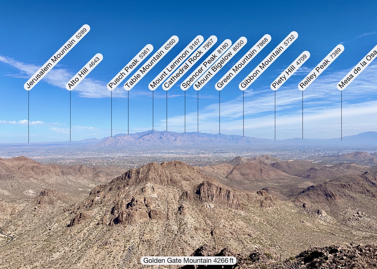 |
| The view from the Golden Gate summit, looking across the way at Bren Peak below the view of the Santa Catalina Range. |
 |
A closer view of Bren from further down the mountain on our descent. |


