Friday, January 14, 2022

Seven Falls to Phoneline Loop

I wasn't sure I'd be up for an 18-mile hike after Wednesday's near debacle on Blackett's Ridge, but I actually felt great today. 

I'd always wanted to hike the Bear Canyon Trail past Seven Falls. Seven Falls is a moderate, low-hanging fruit of a hike that attracts primates by the hundreds on the weekends. I first hiked it nearly 30 years ago, and again in 2017 and 2021. While I've long loved the Seven Falls hike for the beauty and, well, the falls, I was always curious as to what lay north of Seven Falls and Thimble Peak, and I was pleasantly surprised. I have hiked north of Phoneline once before, while on another 18-mile hike, the out-and-back to Hutch's Pool, with friends Stan and Misty in 2020, so I had some idea of the topography. 

This loop is officially called Seven Falls to Phoneline, and rated as a hard hike. It's actually composed of four trails: Bear Canyon, East Fork, Sabino Canyon, and Phoneline.


The water was flowing at Seven Falls, due in no small part to the rains we had a week ago.


We had five crossings of the creek, mostly boulder hopping. Didn't get wet, which is a plus at the beginning of a long hike.


Boulder hopping GIF (Courtesy of Misty Atkins).


Thimble Peak, around which we would somehow get.


Another shot of the falls.


Looking back down Bear Canyon, whence we'd come. Sprawly invasive primate habitat in the background.


Lots of water everywhere this day.


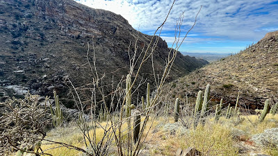
The blue skies gave way for clouds around noon providing a dramatic backdrop as the landscape opened up beyond the canyon.


A panorama near the apogee and the midway point.


The trails were a little overgrown as most folks don't venture out this far. We saw three hikers in all past the Seven Falls. 


After Bear Canyon, we took the East Fork Trail to the Sabino Canyon Trail and finally to the Phoneline trail to complete our loop. There was a surprising amount of fresh trail work. The fires and monsoons of the past two years really took a toll on the landscape, especially the trails which were eroded away in spots. Good to see the U.S. Forest Service is on top of things here in the Coronado Wilderness.


Beautiful Sabino Canyon.


Wednesday, January 12, 2022

Blackett's Ridge, Twice

One reason I keep a hiking & biking blog is to document my physical (some might also suggest mental) decline as I age off this orb. Likewise, when I re-hike a particular trail, I like to compare my time to previous attempts to document any decline. That is one reason I have hiked Blackett's Ridge so many times. It's a real test of stamina despite its short 6 miles—and it's relatively close by.

My goal this afternoon was to eclipse my previous best time of under 2:15 up this craggy ridge and back, which I accomplished hiking with my pal Ira in 2019. 

Little did I know after summiting in a great time (1:09) that it would all be for naught, that my 6-mile hike would be over 9 miles, that my elevation gain up Blackett's would double to 2,600 feet, that I would run out of water, and that I would be lucky to get off the trail before dark.

I made great time to the top. The actual Blackett's Ridge Trail, which forks off the Phoneline Trail after 1.6 miles is 1.3 miles long and 1,300+ feet of elevation gain, making it quite steep. This is the trail I would do twice.  

I started my descent confident that I would easily finish in under 2:15, and hoping for under two hours if I really hoofed it. This would prove to be my literal downfall. About ⅛-mile down from from the summit, I tripped and took a hard fall into the boulder- and rubble-strewn trail, drawing blood and injuring my beer-drinking right elbow. I was a bit in shock, but quickly assessed my injuries, and figured they were minor enough to allow me to keep going at the same pace.

After reaching the bottom, where Blackett's Ridge Trail meets Phoneline, I reach for my new iPhone 13 Mini to check my time. It was no longer in my shirt pocket; it'd obviously been dislodged during my fall at the top. I had no choice but to hike up Blackett's again, despite having only a few sips of water left.

I climbed back to the summit, slower this time, and began my phone search in the upper reaches. I was unable to find my phone and figured I would be up the next morning with Patty's phone to use the find-my-phone feature. While back at the summit, I ran into Steve, from Northbrook, Illinois and asked if he'd found a phone. He hadn't but asked for my number and tied to call it several times. He said if he found it he would turn it in to the Visitor Center. 

Short story long, another hiker found my phone and I now have it back. Now I have to get back and do the hike right.


The hike starts out as a sandy stretch for the sauntering crowd.


The Phoneline Trail is where the rockiness begins.


The last little push to the summit is kinder than the rest of the trail. 


Saturday, January 8, 2022

Douglas Spring to Cow Head Saddle

I finally got out for the first long hike of the year—19 miles—after having to scotch a 17-miler on the 4th because a snow melt- and rain-engorged stream kept us from the trailhead. In the mean time, I've been doing un-noteworthy short hikes just to keep in shape for the longer hikes like this one. 

This was a makeup hike and boy did it deliver. In addition to the mileage, there was over 3,800 feet of elevation gain. But the trails were in great shape, even after we passed the Bridal Veil Falls turnoff. Most people on the Douglas Spring Trail only hike the short 5.5 miles out to the falls and back, so that first section of the trail gets all the attention from the trail building folks. After the falls we saw only a couple other hikers. Beautiful weather today, highs in the low seventies and a slight wind.

I've hiked this trail to the Saddle twice before, once a solo out-and-back, with no side trip to the falls, and the next time with my hiking pal, Misty, as a point-to-point, from the Douglas Spring Trailhead to the Tanque Verde Trailhead. That hike bested this one in distance (20 miles) and elevation gain (4,900ft).


Temps were around 40º at 8 when we hit the trail, but I soon doffed my fleece.


Near the Douglas Spring Campground where we had lunch on our return. I camped at this campground a couple of years ago with my brother as we tested out out new backpacks we bought for the Grand Canyon Rim-to-Rim-to-Rim backpacking trip we had planned for May of 2020. That trip never happened as the park closed in May. I now plan to hike it in May of this year after recently securing the hard-to-get permit.


Moi.


Misty.


Riding my Birthday, and a Bit of My Friend’s to Boot

I rode my birthday yesterday after taking my 69th off last year because I was still recovering from shoulder surgery in May from my hiking ...