Thursday, December 30, 2021

Maiden Pools Via La Ventana

I needed a short "bridge" hike as prep for an upcoming 16+ mile hard hike, this Sunday or perhaps Tuesday, the first of 2022, so I chose the beautiful, short, but challenging Maiden Pools. 

I've hiked this trail before, twice, but bypassed Maiden Pools each time on my way to La Ventana (The Window), a much longer hike. This one is only 5.6 miles, but the nearly 1,400 feet of elevation gain come fast and hard the last mile or so, qualifying this short out-and-back as hard. It is also quite rocky and potentially ankle twisting. And while my ankle is still a little sore, I'd rate it as 95% recovered from Pontatoc Ridge. That I passes two trail runners on the way up, I'd say that's pretty good evidence I'm back to my hiking groove.

Starting out, there were insinuations of blue sky poking through the clouds, but those clouds eventually took over and even dropped some rain. With the temperature only sixty degrees, rain isn't nearly as agreeable as it might otherwise be in this desert-where-no-f-ing-primates-should-live.


My average  pace ended up being under 25 minutes/mile, so not bad for such a rocky, steep trail.


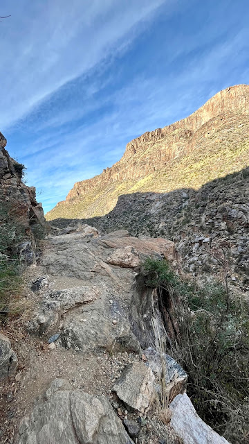
Here're (above and below) examples of some of the rocky stretches of trail.


The trail starts out like this for the first mile, as it traverses the "private property' of La Ventana Resort, who deigned to give hikers access. That, and because they were required to by law.


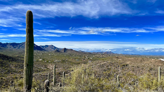
Looking back south, at Tucson sprawl.


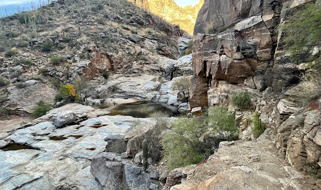
The pools were mostly bereft of anything but standing water in places.


Tuesday, December 28, 2021

Monsoon Loop Via Slingshot and Mosaic Trails

Rain and cooler weather this week scotched my plans to hike Mount Wrightson via the Figure 8 Loop, a hike I did about three years ago. I didn't want to chance getting caught in deep snow like I did on Sutherland, also about three years ago (perhaps my most scary and epic hike ever). So this left me to find some shorter hikes I could do in-between rains. This afternoon was cool (low sixties) but the sun did manage to make an appearance. So I went searching for a short hike, something in the five mile range. I stumbled on the many trails in the Painted Hills Trails Park. Here I figured I could piece together a respectable loop, which is what I did. 


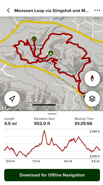
The route I chose combined the Monsoon Loop via the Mosaic Trail with the Slingshot Trail. To give myself a little more elevation gain, something sorely missing in these trails, I also hiked to the top of the Bactrian and Recoil summits (more molehills than mountains). 


The map from which I operated. I immediately had to turn off AllTrails' off-trail warning as I almost immediately went off the Mosaic Trail and onto the Slingshot (dotted blue line above right).


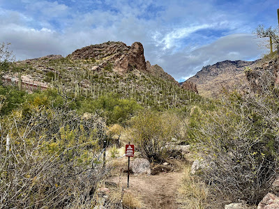
This area is rife with saguaros and is in fairly close proximity to Saguaro National Park West.


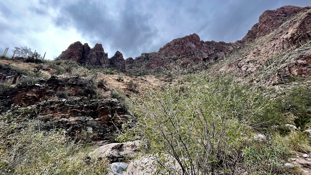
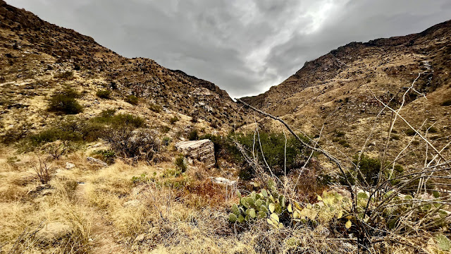
About 2 miles in I climbed to the top of Bactrian Summit (2780 ft.). Not much of a hill, but nice views of the Santa Catalinas and Tucson's horrendous sprawl.


After descending Bactrian Summit, I noticed there are actually two summits, two humps, hence the name.


Recoil Summit had a cairn marker just so you know it's a summit. Similar views to Bactrian. Might have called it Dromedary Summit, just for symmetry.


After the hike, I thought I'd check out a craft beer store on this side of town in the outside chance they'd have my favorite beer in the whole wide world. I was shocked to find out they did and so bought their last two six packs. Bell's isn't that well known in Arizona. and lucky for me, the folks down here don't know what they're missing (or perhaps it's the rather steep price).


Thursday, December 23, 2021

Bear Canyon to Seven Falls

It's been over 25 years since I first hiked to Seven Falls and almost five years since I last did so. Any chance I thought I had to better my time from 2017 evaporated when I checked my AllTrails app back at the visitor center: 8.7 miles in 2:59. I lost almost 20 minutes from that last hike. I blame my ankle, which I injured December 4 descending Pontatoc Ridge in an attempt to better my previous hike of that trail. One would think that advanced age would nip such silly self-competitiveness right in the ole bud. But no. However, in a concession to common sense, I was wary of re-injury and the chilling effect of that apparently slowed me down by about two minutes a mile. 

I made a special effort to rise early and hit the trail by 7:30. This trail is always clogged with primates, but this being a holiday week, I expected a veritable family circus. Ran into one trail runner on the way out, and was passed by another. but that was it until the return. By the time I got to within 3 miles of the parking lot, the masses were out in packs.


Lovely morning light, captured nicely by my new iPhone 13 Mini. My beloved five-year-old iPhone SE finally gave up the ghost last week—yet another casualty of rapacious capitalism's planned obsolescence.


Another benefit of hitting the trail just after sunrise, is meeting fellow travelers like this little guy.


Not nearly enough of these smooth, sandy stretches.


This trail hugs the lower reaches of the canyon walls, with frequent crossing of the stream bed, sometimes via rock hopping. Mostly, though, the stream was a trickle.


Looking back toward Tucson.


This time of day, the trail is mostly in shadows as the sun arcs its way toward noon.


The beautiful Santa Catalinas.


First glimpse of the falls, or what would be falls if there were more water.


The pools are still mostly full from the last flow, however.


Nary another soul, very meditative.


Another view of whence I came.


Sunrise reflected.


Typical stream crossing.


Saw this sign as I approached the trailhead at hike's end. They really need signs to warn mountain lions of primate sightings.


Pontatoc Canyon-Finger Rock Loop (Warning: Unofficial)

  I have read two or three AllTrails hike descriptions mentioning a possible new trail connecting Pontatoc Canyon and the Finger Rock Trail,...