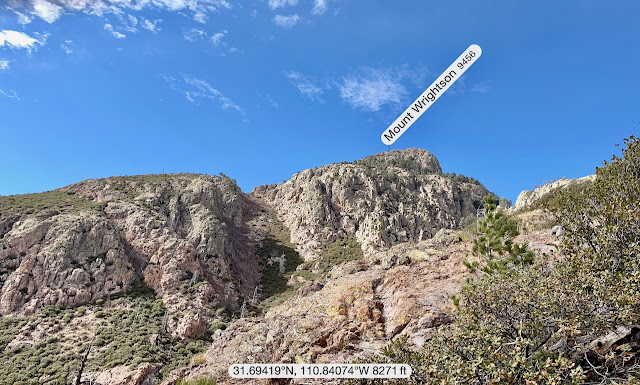
I hiked this 9,400-foot, 14-mile Super Trail loop up Mount Wrightson ten days ago with my hiking partner Misty. But since I wanted to introduce my Michigander friend Jack to it as well, I hiked it again today. And actually, this is a slightly different hike; that was the Figure-8 Loop hike. It is slightly shorter because of the shorter, yet steeper ascent starting out on the Old Baldy Trail to the Josephine Saddle, from whence all routes ascend to the summit. This is more of a figure-P loop.
What I like about this hike, aside from the intense 4,000 feet of elevation gain, and perfect length in that 12-20 mile sweet spot, are the trails: well-kept, mostly boulder-free, and fairly low traffic, especially during the week. We did run into a small gaggle of Canadians toward the top, and three or four casual hikers on the lower reaches, but we mostly had the mountain to ourselves.
This Super Trail, in my opinion, is the best introduction to Wrightson's many magnificent views from the highest point in the Santa Rita Mountains. Wrightson is recognizable from much of southeastern Arizona by its barren, pyramidal peak 7,000 feet (2,100 m) above Tucson. While I love the views from the top, my favorite part of this hike is the lariat loop that snares the entirety of the upper reaches, a nice smooth trail that gradually descends from the Crest Trail spur that takes you 600 feet up to the 9,456 foot summit. I recommend hiking this clockwise as it slowly descends from 8,800+ feet around and down to Josephine Saddle at 7,200 feet, from where we ascended. Here the Super trail wends its way back down to the Madera Canyon trailhead, four miles and 1,700 feet below.
More great weather today (aside from the brisk winds and chill at the top) brought to you by La Niña and climate change. 50º at the start around 8:15; 70s at hike's end a little after three.
 |
| View from the trailhead at the Madera Canyon parking lot. |
 |
| View from Old Baldy Saddle looking south at the destruction of the 2005 Florida fire. |
 |
| Roughly the general lay of the land brought to you by the Peakfinder app. |


.jpeg)


.jpeg)


No comments:
Post a Comment