Wednesday, November 27, 2024

Bike Ride to Catalina State Park

This is a hiking and biking blog, so this is a biking post.


I brought a bike this year like I did in 2019, when my brother Jon and hiking buds Misty and Jack and I  crazily rode the 26 miles up Mount Lemmon (and screamed at 40 mph on the downhill return). This is a different bike, thank the gods. That bike, while it was a cool, vintage Klein mountain bike (see addenda), made in Washington State, never-the-less had an old Manitou fork that wouldn't lock out, thus absorbing only my effort and energy. Try that for 26 bouncy miles up hill, especially as an elderly person. But more later on this year's bike.

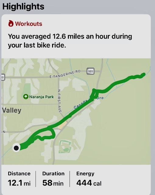
I really had no choice but to bring a bike since the place we're living is only a few short yards from the Cañada del Oro River Park Trail, which connects to the entire 130 miles of trails around Tucson. It also connects to the spur trail I rode north today up to Catalina State Park—a mere 12 miles round trip. My destination today was the parking lot adjacent to the Romero Canyon and Sutherland trailheads, a couple of my favorites. I figure in the future I could ride out for a hike.

The yellow circle marks the gate to the bike and pedestrian 
path. Our front gate is in the foreground.


Not sure which map graphics to use with my plethora of apps, so in the mean
time, I'll experiment. Not nearly as crisp as AllTrails.


Really nice bike facilities in Tucson, and to a slightly lesser degree here in Oro Valley. Look ma, no corn fields. 


I am back to wearing my resistance shirts since we apparently just elected a fascist Nazi wannabe.


The bike I brought this season is a 30-year-old Giant Cadex, back when they were experimenting with carbon fiber. My great friend Deano gave me this bike as he was cleaning house. It's composed of three carbon fiber tubes main tubes (top, seat, and down tubes) plus the seat and chain stay tubes, all tucked into aluminum lugs. It's finished off with a chromoly fork, for safety. Yes, that is a Brooks Cambium C17 all-weather carved saddle I bought online from my favorite shop, Modern Bike, and picked it up in Des Moines at their store and warehouse.

After I cleaned it up and replaced a few components, I realized I once had a bike quite similar to this, in yellow and black, but with the Giant label. I bought it from College Park Bikes while in a Chinese summer program at the University of Maryland in 1993, so it was probably a year newer than this one. I took it back the day after buying it as I wanted a more practical bike I could also use for commuting to work. I ended up with a top-of-the-line Trek 970, one of their last lugged chromoly bikes, and still made in Wisconsin. I still have it, but converted it to a cargo bike (see notes). It sports a paint job by my good friend, exquisite bike frame builder, and painter nonpareil, Jeffrey Bock. Do yourselves a favor and seek out his bikes.
  

A bit about the bike. It was a bit dusty when I picked it up from Dean. I swapped out the stem and bars, replaced the brake levers, and bought a used pair of Shimano 7-speed indexed thumb shifters from a gent in Portland, Oregon to replace the melted grip shifters that were probably original to the bike. I overhauled the hubs (bearing races were mint, but the grease was old), head set, and bottom bracket. 

New water bottle cages and pedals which I originally bought for the Klein, which a barely rode. Even though the Giant name does not appear on the bike, Cadex is indeed a Giant brand, and still produces high-end niche parts and frames. 

All-original Shimano XT components that are in excellent 30-year-old condition. I added new 2.1-inch Schwalbe tires. This is a fun, retro bike to ride,. A hard tail and no hydraulic fork, it feels like my first bike. I just might have to retackle Mount Lemmon this coming spring.

Notes & Pics


January, 2019, Mount Lemmon


Sunday, November 24, 2024

Pima Canyon Trail to Mt. Kimball


The Pima Canyon Trail is finally fully open and hike-able in its upper reaches after the devastating Bighorn fire in the summer of 2020 scorched 120,000 acres of the Santa Catalinas. I hiked up to where the Bighorn fire descended into the canyon, in February of 2022 (see pic below). That was a little over four miles up, just past the dam. It was a shocking change from a previous point-to-point hike Misty, Jack (Jacques, from Quebec) and I did in January of 2019, nearly six years prior. 

This trail is actually two hikes: the low hanging, easily-accessible first two-thirds rates as easy to moderate and attracts a lot of traffic, mostly casual hikers; the final third is a very hard and steep climb that winnows the hikers down to a few crazies, like us. We saw only three other hikers past the dam.

The first four miles, up to the dam—a popular destination—sees an elevation gain of only about 1,500 feet and I consider that an easy to moderate hike; the last 2+ miles to the summit accounts for the remaining 3,000 feet of gain, with grades of 20-30-even 50+ percent. This segment is a different hike altogether, very hard and somewhat dicey, as the 2020 fire destroyed many parts of the trail and it hasn’t yet been fully restored by the park service. They tend to focus on the well-trafficked segments; even rerouting portions. They did that on the Pima Canyon Trail starting about mile 3.1 and AllTrails hasn’t yet updated their map, which threw us for a literal loop, and adding to our confusion as well as our mileage (see photo below). We also had a slight detour toward the top of the canyon when we scrambled/crawled up the steep (55% grade) side trail to the Pima Saddle only to have to slide back down when we realized our error.

Great weather, albeit a bit warm on the afternoon descent. A whopping 55º at the start around 7:15, warm for this time of year; 75º at hikes end around 4:00.

I think the actual mileage is about a mile less than I 
recorded. Might be a GPS or AllTrails issue I'll have to sort.


The Bighorn fire which burned from June 5th to July 23rd, 2020. The fire was the result of a lightening strike. (Photo by Wendy Witzig)

Mortars as I noted on a previous hike: Grapefruit-size mortars used by ancient Arizonans to grind mesquite and other plants. These people were probably of the Hohokam culture who lived here between 200 and 1,400 ce. 


Lots of sunny blue skies, but quite shaded at trail level until around noon.


Very little water during this draught. (Photo by Misty Atkins)


(Photo by Misty Atkins)


The dam, such as it is, is a popular destination, perhaps because it's a good lunch spot, and also because the trail takes a sharp turn toward the steep a half mile earlier, around the 3.5 mile mark..


The sun finally popped over the ridges around noon.


This photo barely captures how trail grew progressively sketchy and even dangerous in spots, especially in the upper reaches where is is precipitous.


(Photo by Misty Atkins)


(Photo by Misty Atkins)


(Photo by Misty Atkins)


(Photo by Misty Atkins)


(Photo by Misty Atkins)


The entire ridge between the Pima and Finger trails looks like a zombietree apocalypse.


Yes, add a damned arrow as there is an actual spur trail to the summit. Criminy.


Misty, looking for her roof.


We had a stunning lunch spot.


(Photo by Misty Atkins)


(Photo by Misty Atkins)


~300º view of the top.

(Photo by Misty Atkins)

(Photo by Misty Atkins)


Overall, a fairly shaded day until afternoon and of course on the ridges and summit. (Photo by Misty Atkins)


Friday, November 22, 2024

Arizona State Park Pass Time

I have never liked the suburbs, primarily because they helped destroy the diverse cities of the past. They also tend to be cultural deserts for much the same reason—a lack of diversity. But I will say, there are at least a couple of not-insubstantial benefits to living on the edge of culture, at least in Tucson, Arizona: beautiful views of my favorite hiking range, the magnificent Santa Catalina mountains; and being able to reach some of my favorite trails with a 12 minute drive, or a 24 minute bike ride on a trail system 50 yards from our town house. So today, I took that 12 minute drive straight to the Catalina State Park ranger station and slapped down a mere $75 for an annual pass to all of Arizona's state parks. 

While I was in the park, I also had a bit of a hike up Romero Canyon toward the pools. I only had an hour-and-a-half, so couldn't make it all the way to the pools 3 miles in (even my 3 mph pace would leave me 30 minutes over), but did manage a pretty hearty workout, abetted in no small part by the blistering temps (83 is blistering for me).


View out the picture window of our place. The saying down here is, when the mountains turn pink, it's time to drink, so I believe I'll have me a Dragoon IPA (my go-to local replacement for Confluence's excellent Des Moines IPA).


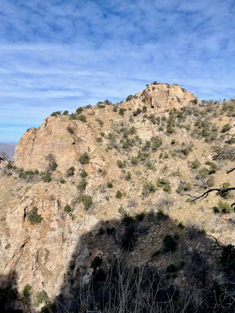
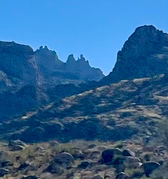
Finger Rock from the north side, or a proximate look-alike. One of my other favorite trails in the Catalinas is Finger Rock, with many combinations of hikes: Finger Rock-Mt. Kimbal-Pima Canyon trails out-and-back; Finger Rock to Mt. Kimball; and many others I have yet to try. Planning Pima Canyon to Mt. Kimball Sunday, two days hence. 


Closeup of Finger Rock's back side.


This pic and the one below are what two miles up the Romero Canyon Trail looks like.


Wednesday, November 20, 2024

Wasson Via Sweetwater 2024

Back in hiking nirvana once again—and I must say, for a much-needed psychic boost. As per my declaration last year, I now have a new tradition of hiking itty-bitty Wasson Peak (elev. 4,640 ft.) as both the first and last hikes of the season. And since there are several approaches to this rather diminutive peak, it doesn't get old for me. 

Joining me today is my pal Jack from Michigan. He also accompanied me on my last hike in February when I finally hiked the Hugh Norris approach up Wasson. 

Saw a few other hikers today, none hiking our rather blistering 2.9 mph pace, which translates into 20.52 minutes per mile; not bad for the rocky 9.2 miles and 2,000+ feet of elevation gain, and roughly the same pace as last year. 

Beautiful weather with temps of 48º at the start, around 8:30, topping out at 74º by hike's end. A bit windy on the ascent, but oddly much less wind at the summit.


Jack. A youngster, really, at 56.


(photo by Jack Byers)


Jack Byers Peak

The view from the top, looking northeast. Picacho is the only one of these I have hiked, and it is usually an annual occurrence. Jack, my hiking partner Misty, and I  hiked it in late January of this year.


Alamo Canyon Loop Trail & Romero Ruins

Had a little over an hour to kill this morning and needed to shake the Miller Peak dust off my hiking boots and replace it with new dust fro...