Thursday, February 15, 2024

Brown Mountain

I decided to scotch my planned hike of the Agua Caliente Loop this AM due, once again, to high water. I have been meaning to do this loop after hiking up Agua Caliente Hill a couple times in the past, and never venturing into the beautiful canyon it skirts; this loop would have remedied that. I replaced Agua Caliente with a hike up and around Brown Mountain in the Tucson Range on the west edge of town (near the magnificent Arizona Sonora Desert Museum). I have driven past Brown Mountain on numerous occasions hiking in the Tucsons, most recently on Tuesday hiking nearby Wasson Peak, and have mentally banked it in my tertiary hike vault.

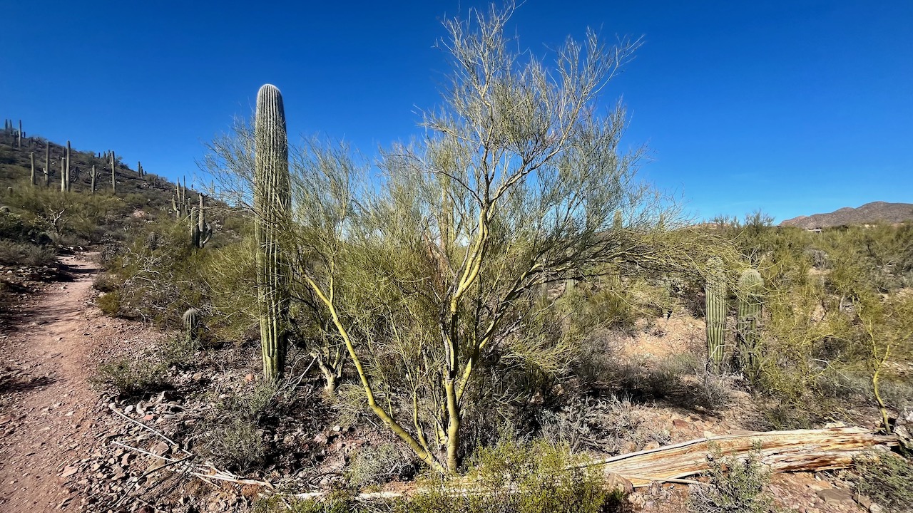
This is a short hike—a little over four miles (hardly worth the 30-minute drive)—but quite scenic situated as it is in the Saguaro National Park West. So, lots of everyone's favorite cacti. And speaking of cacti, everything was quite verdant with the last few rains (see collage pic below). Quite rocky on the uphill start (I hiked the recommended counterclockwise direction) but not nearly so rough as the 13-mile Weaver's Needle Hike in the rocky Superstitions up north. 

I think in the future, I will supplement this hike with a quick jaunt up the short, steep Tumamoc Hill I now regularly use as a training hike. I pass near by it on the way back to town. That would at least be a respectable 7 mile combo, and all doable in a couple of hours (sans drive time).

Beautiful clear skies today, weather at the trailhead over 50º to start, over 60º at hike's end on its way to a high of 73º.


Brown Mountain is actually two small peaks mushed together, a bactrian summit, if you will.


Cacti showing the effects of sufficient water. Clockwise from the left, ocotillo, barrel cactus, blue palo verde, and the cute, cuddly teddy bear cholla (dare you).


More of the Tucson Mountains.

The initial uphill was steep and rocky.


The saddle between the two humps.


Tuesday, February 13, 2024

Wasson Peak via King's Canyon, Hugh Norris, and Gould Mine Trails

Warm, sunny weather has finally returned after a couple weeks of climate change-driven el Niño rain and cold, trailings from the two atmospheric rivers that recently swept down the West Coast. A perfect morning to introduce my pal Jack, a Michigander, to the joys of wide-open, sunny Wasson Peak, the highest point in the Tucson Mountains just west of town. 

There are at least three approaches to this popular summit: the 9.7 mile Hugh Norris out-and-back, which I have never done; the 9.0 mile Wasson Peak via Sweetwater Trail, another out-and-back, on which I began this hiking season; and the loop we took today, which checks in at only 7.8 miles and 1,860 feet of gain. All three hikes are rated as hard, but none of them really are.

I have hiked this trail several times before, most recently last February. Each time but one, I hiked it counter clockwise as I find the King's Canyon approach the least appealing, because of it's rockiness, and the relatively less dramatic landscape.

The whole area is rife with saguaros sited as it is in the Saguaro National Park (West). And with all the recent rain, the cacti were really popping with new green growth, especially the ocotillo.

Weather at the start just past 9am was ideal; temperature around 50º and little wind; mid-60's 2 ½ hours later on our return. beautiful day, with nary a cloud overhead.


King's Canyon, an old mine access road, starts out rocky and steep.


There are a few old mining remnants on this trail.


The ocotillo are particularly verdant now.


Wasson offers 360º views from the summit.


Friday, February 9, 2024

Douglas Springs Campground and Two Falls

There is a Chinese saying that's apt when disappointment turns to good fortune: 塞翁失马 (sàiwēngshīmǎ)—Who's to say it's bad luck? We were intending on hiking the 22-mile Bear Canyon-Thimble Rock-Phoneline loop today, but Mother Nature had different ideas. Because of recent heavy rains (thank you climate change), Bear Canyon is roaring and dangerous, and that hike requires several stream crossings. So I chose the one place (so I thought) where water wouldn't be an issue: the 19-mile out-and-back in the Rincons—the Douglas Spring Trail to Cowhead Saddle. 

I have done this hike many times, most recently last year. However, after reaching the Douglas Spring Campground, we found our progress stymied by...a water crossing. There was also snow up ahead, so we decided to let cooler heads prevail and lopped the final 5 miles off the hike and turned around. We instead decided to visit two trail-adjacent waterfalls to add a couple miles to our now paltry 13.5-mile hike. Great decision as the falls were really flowing. We had lunch at the breathtaking Bridal Wreath Falls, and followed that up with a quick jaunt iver to Ernie's Falls. Both falls were more impressive than I have ever seen them. Even Ernie's Falls—always a bride's maid, never a bridal wreath—was impressive. I hiked to both falls a couple of Mondays ago with my pal Jack, and the contrast was striking

Overall, we ended up with a great hike today, with cool temps near 40º at the trailhead at 8am, rising to 60º at hike's end.


Snowy Mount Lemmon peaking up from behind the Santa Catalina's.


Lots of water even at the lower reaches near the trailhead.


Douglas Spring and the adjacent Douglas Spring Campground.


Cowhead Saddle (white knob in the distance).


Bridal Wreath Falls from the main trail. Photo by Misty.


Approaching Bridal Wreath Falls on the spur
trail from the main Douglas Spring Trail.


We scaled a side trail up near the falls to capture this 
amazing Saguaro and the falls as a backdrop. A view 
maybe worth the hike all by itself.

Bridal Wreath from above. Video my Misty.

Bridal Wreath Falls.
Photo by Misty.

Misty.

Ernie's Falls.

Close-up photo by Misty.


Hugh Norris Trail to Wasson Peak 26

Today, we hiked the 10-mile Hugh Norris Trail to Wasson Peak, which also has around 2,400 feet of elevation gain.  I hiked extra hard today ...