Rarely do I get a chance to show, in two adjacent hikes, why trail conditions matter. Sunday I hiked the David Yetman trail here in Tucson with my pal Jack; today, it was the Weaver’s Needle Loop two hours north, with my hiking partner, Misty.
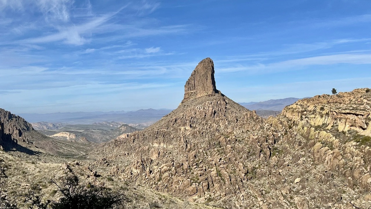
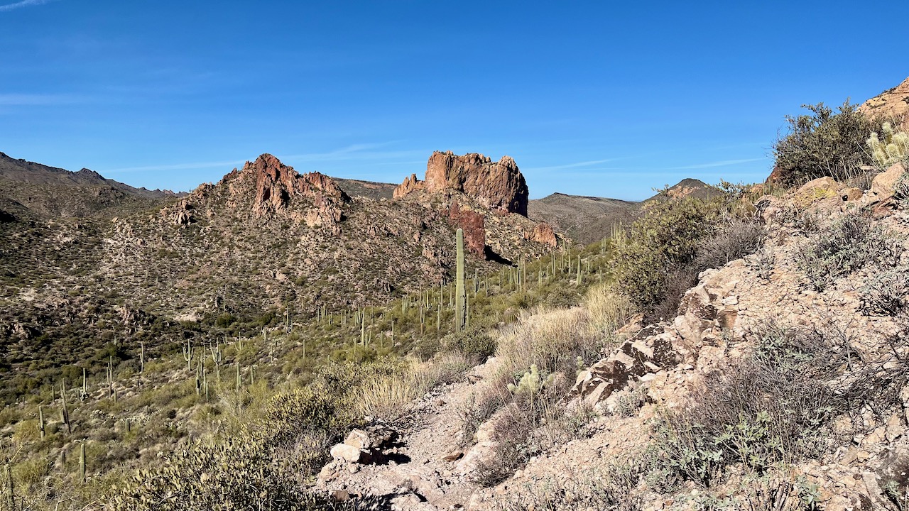
The Weaver's Needle Loop is in the Superstition Range just east of Phoenix, near Apache Junction. Superstition mountain is famous—or rather infamous—for being home to the Lost Dutchman Goldmine. Legend has it that there is a rich gold mine hidden somewhere near the Weaver’s Needle, a magnificent volcanic remnant that rises up majestically from the floor of Peralta Canyon. Several people have gone missing over the decades looking for the mine, a search that goes on to this day. We, however, are driven not by gold and greed, but by the incredible canyon views. The Peralta Canyon and its hoodoo sentries are motivation enough.
Both trails are roughly 12.5 miles long. The Yetman has 1,300 feet of elevation gain, while the Weaver’s Loop trail more than doubles that. But what really separates the two trails is the incredibly rockiness of the disparate trails comprising the Weaver’s Loop. For comparison, and to reflect the importance of train conditions, our pace on the Yetman out-and-back was 3.2 mph; the Weaver’s Loop, a stodgy 2.4. This was perhaps the rockiest trail I have ever hiked, with large boulders to scramble over, smaller boulders primed for wrenching an ankle, and scree-cloaked inclines that challenge any ascent or descent. Were it not for the amazing views, I would not recommend it. But the views are incredible, and might be enough to bring me back for a redux. That said, I am glad I finished it, and don’t need to hike it again in the immediate future. And with that dies my dream of finding the the Lost Dutchman Gold Mine that will make me filthy and rich.
I really recommend hiking the loop counterclockwise for a couple of reasons. The trail is mostly sun-drenched, with the only respite on the last leg: the Peralta Trail. The late afternoon sun dips behind the hoodoos, and overgrown foliage keep the trail shaded or sun dappled. Also, arguably the most beautiful views are toward the end of this route.
The trail was mostly easy to follow, with the exception of around 5 miles in from either trailhead, where it was quite overgrown. I would recommend long pants on this trail. While there are multiple wash crossings, there was no water flowing and one can get by without waterproof boots. And ankle-high boots are highly recommended lest one suffer a sprain from the rough terrain. We hit the trail at 8:30 and saw no other hikers until we hit the Peralta Trail at around mile 8. Get to the trailhead early as the lot fills up by 9. I used all of three liters of water. Temps were 50°-73°.
 |
View from the parking lot. The lot fills up quickly after 8:30.
|
.jpeg) |
| (Photo by M |
 |
Where we are heading.
|
 |
Phoenix is somewhere over that last hill, thankfully its unsightliness out of sight.
|
Video panorama from the hike's apogee.


.jpeg)


No comments:
Post a Comment