Monday, January 30, 2023

La Milagrosa Canyon Trail

This season's been marked by a dearth of longer hikes, but I have managed to fit in a few 10-milers, and we have a 20-miler planned on Saturday. 

Today, we settled for yet another 10 mile hike, but one that did give the lungs a bit of a workout on the ascent. 

The Milagrosa Canyon is really quite stunning. It's tucked into the convergence of two mountain ranges, making it difficult to determine exactly to which range it belongs: the Santa Catalinas on the north, or the Rincons, which abut from the southeast. Two years ago, Misty and I joined a hike led by Stan from the Baja Arizona Hikers. That was a point-to-point hike that started on Milagrosa and ended up at the George Hirabayashi campground on Mount Lemmon—decidedly in the Catalinas. 

Today's was a simple out-and-back, and a gorgeous day it was. Chilly 36º at the trailhead shortly after 8:00am. The sun was out, however, and after a mile or so of climbing, jackets and gloves were doffed and the temps climbed as we did. Mid sixties by the time we got back to the car a little before noon.


A peek into a Milagrosa ravine, with the sun in an unfortunate blinding sun spot, which I was attempting to use the saguaro to block.


Photo by Misty

Photo by Misty


Lots of water this year, and the pools did not disappoint.


Misty checking out the precipitous cliff walls of this little gorge.


This landscape is not dissimilar to the adjacent Saguaro National Park, decidedly in the Rincons, where we will be hiking up to Cow Head Saddle on Saturday.


Gorge-ous shot by Misty.


Saturday, January 28, 2023

Phoneline-Sabino Canyon Loop

Finally got out on an actual hike (not a walk); first one in over a week. Chose the Sabino Canyon Recreation Area despite it being a weekend, and sure enough, I had to park in the overflow parking. There are numerous trails in this amazing amenity smack dab in the middle of a residential neighborhood. Were it not for "protected" places like this, all of Arizona would simply be one big development.

I had about three hours to kill, so I chose the Phoneline-Sabino Canyon loop at around 10 miles. This loop follows the Phoneline Trail which climbs up the east side of Sabino Canyon far above the creek and tram road below. Hike this about six miles to the end then take the half-mile switchback down to the end of the tram road and tram stop no. 9. The rest of the hike is on the tram road back to the visitor center. 

The trails were crawling with bipeds, especially close to the start, but after two or three miles, I had some quiet alone-time.

I was surprised to see so much water over the road as Sabino Creek was especially high with snow melt from recent weather. We've had a lot of rain (snow at elevation) the past month, and the Canyon was especially lush and verdant, and a lot of water flowing. I counted five water crossings on the return, and I just kept my hiking shoes on making for a sloppy, squishy last three miles. I was saved by my Darn Tough wool hiking socks, made in the great state of Vermont.


Normally, I would start out at the visitor center parking lot and be right on the Phoneline Trail, But since I parked in the overflow lot, I first had to take the tram road about ¾ of a mile back to the visitor center.


The trail work on the Phoneline Trail is pretty astounding, as evidenced by this wall (center of photo).

Close-up of trail wall.


Mount Lemmon peeking out above Sabino Canyon.


The trail switchback I will take when I reach the end of Phoneline.


I had to cross five of these Sabino Creek overflows. Normally I would have doffed my shoes and socks like this person, but today I couldn't be bothered, mostly because I only had three miles yet to hike.
(Pic stolen from the inter webs as I failed to take one.)


Thursday, January 19, 2023

Douglas Spring and Bridal Wreath Trails

Today we were supposed to hike the 19-miles to Cow Head Saddle and back, but since Misty had a conflict, and for safety reasons, I decided to lop off the last five miles as nary a soul usually goes that far and lord knows this would be the day I had a fall or worse. So I hiked only to the Douglas Spring Campground, which I have hiked to many times, and even backpacked to almost three years ago, with my brother. I also added a mile side trip to Bridal Wreath Falls for lunch as I made it to the campground by 10:15, way too early to eat,  but would easily make it to the falls for lunch by noon.

Cool temps in the mid-thirties at the trailhead at 7:45, climbing to sixty degrees by hike's end. No crazy mountain lion stories or eroded trails like the rather scary hike up to the Window from a couple weeks past. Just a little ice to contend with—and not nearly enough to require micro spikes.


Snow-capped Mount Lemmon in the background center.


Trail marker for Bridal Wreath Falls (to the right), or Ernie Falls (to the left). I would be going straight ahead and come back to the Bridal Wreath trail for lunch after the eight-mile round trip up and back from the campground.


Lots of water coming down from Douglas Springs. The trails were saturated in sections, with ice at higher elevations. We've had a lot of rain the past month, primarily second-hand weather from the so-called atmospheric river in California.


6.6 miles in. Cow Head Saddle is another 5 miles round-trip, and I have done that hike at least twice. Misty and I also hiked to the Tanque Verde Trailhead in December of 2019—an epic 20 mile hike with about 5,000 feet of elevation gain—not for the timid.


Tanque Verde Ridge on the horizon. The trail follows the ridge line up to Tanque Verde Peak, and then on to the other main campground in Saguaro National Park East, Juniper Basin.


Cow Head Saddle is not too far from Helen's Dome.


Bridal Wreath Falls was teaming with primates, 
including an entire contingent of seniors from Green 
Valley. Luckily, I was able to edit out all 20+ of them.


Friday, January 13, 2023

Short, Sweet & Steep: Tumamoc Hill

This is my go-to jaunt when I have an hour to shoehorn a training hike into my busy schedule—right there on my retirement calendar between crosswords one and two. It's also a barometer of my general fitness level from year to year: I need only keep a pace of around 15 minutes a mile (4mph). Lacking that, I know I have work to do. My previous trip up, in January of 2020 (before we took a Covid year off), was a tad slower. Perhaps my physical deterioration isn't accelerating.

This might very well be the final hike before Arizona feels the effects of the atmospheric river that has so devastated parts of California. The temps are expected to drop by 20 degrees in the next week, with lots of unseasonable rain. Should make the already burgeoning streams swift and dangerous, limiting access to many local trailheads and hikes. 


Getting a little too close to my ideal pace of 15:00.


This hill is downtown and usually crowded with walkers and runners. 


Wednesday, January 11, 2023

Slavin Gulch and Council Rocks

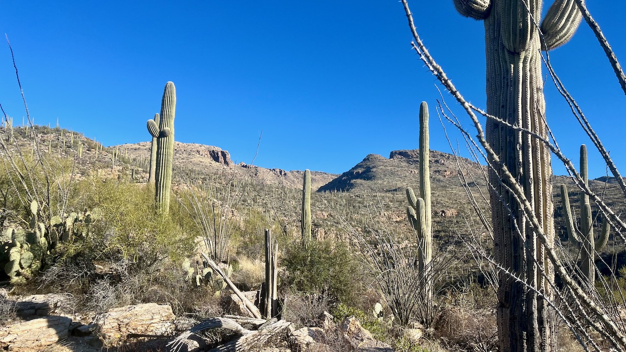
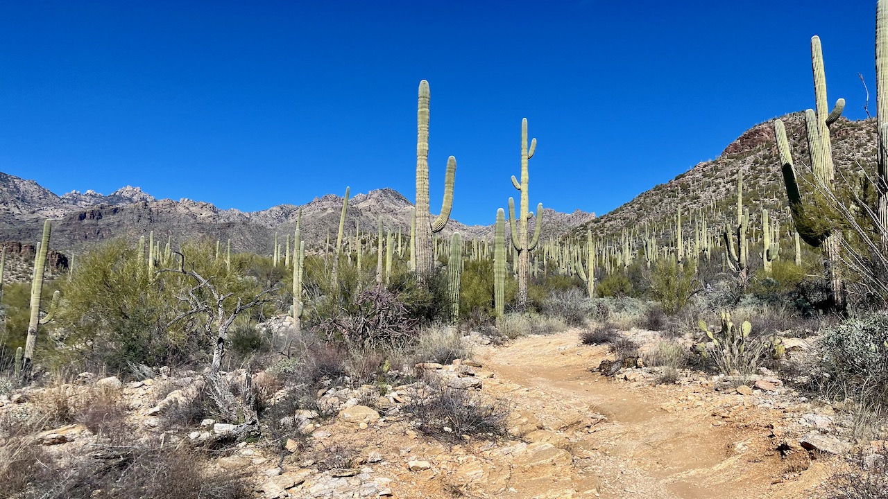
Today's hike was to combine two favorites in the Dragoons: Slavin Gulch (7.2 miles), and Council Rocks (5.0 miles). However, the Council Rock portion was so overgrown with brambles and thorns, we had to ad lib our route and ended up hiking about 15 miles. The mere 2,000 feet of elevation gain made up for the increased mileage.

After clambering up the rocky, boulder-strewn Slavin Gulch trail, we reached the long-abandoned Abril Mine, first opened in 1903, and closed for good in 1953 (primary production during WWII). My previous trip up Slavin, with my friends Ira and Guy, was in January, 2017. That trip we scampered up the steep cliff to the top of the mine—a rather foolhardy adventure. This time, cooler (and in my case, older) heads prevailed. 

Me, heading toward the mine shaft like a 12-year-old. 
(Photo by Guy 01.10.2017)

After the mine, we headed back toward the trailhead in a vain attempt to find the Council Rocks trail. A dense thicket of thorny shrubs and trees prevented us from crossing the gulch and getting to the trail proper (the dotted line on the map below), so we headed toward the trailhead to look for a way through. We finally did find a sketchy trail that would take us the two miles across to the western slopes of the Dragoons where the Council Rocks are.

My previous trip to Council Rocks was in January of 2015, pre-smart phone and hence pre-AllTrails hiking app, so I had no record of the route. I did, however, have a pretty decent camera and was able to capture the other-worldly rock formations that are the real joy of that route—one we would miss today during our near bushwhack—despite all the other incredible sights. That earlier trip was led by a member of the Bisbee Muleteam hiking club, so as a tag-along, I wasn't really paying attention to the route. That we were able to even get to the Rocks today is a testament to my bone-headedness and luck, and that Misty was game for an adventure. I'm glad we persevered.


Slavin Gulch trailhead.


Lots of overgrown brambles on this low-traffic trail.


The view south from the mine.


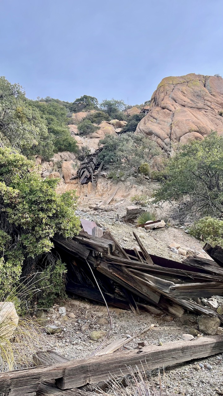
Mine remnants and the way up to the shaft on the 
top left.


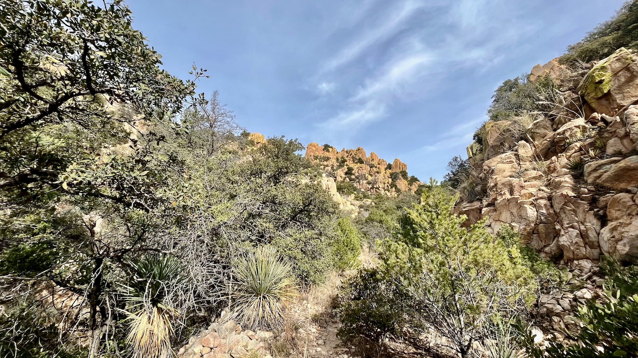
Council Rocks, center foreground.


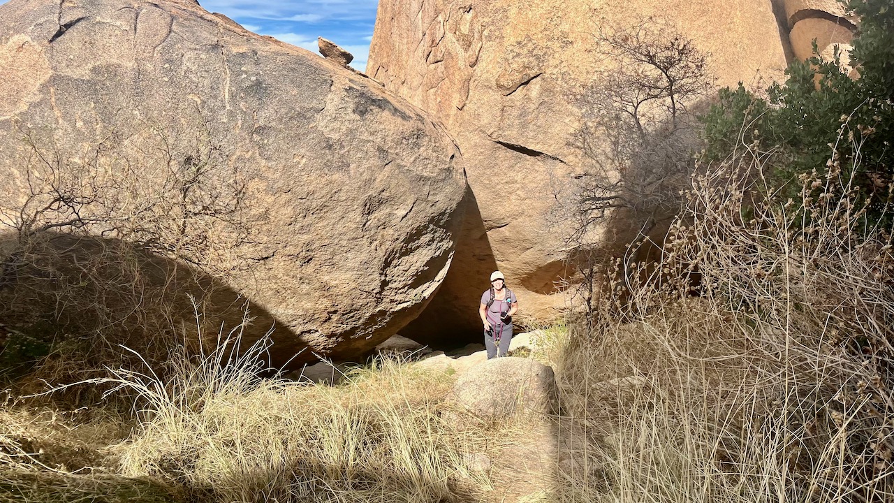
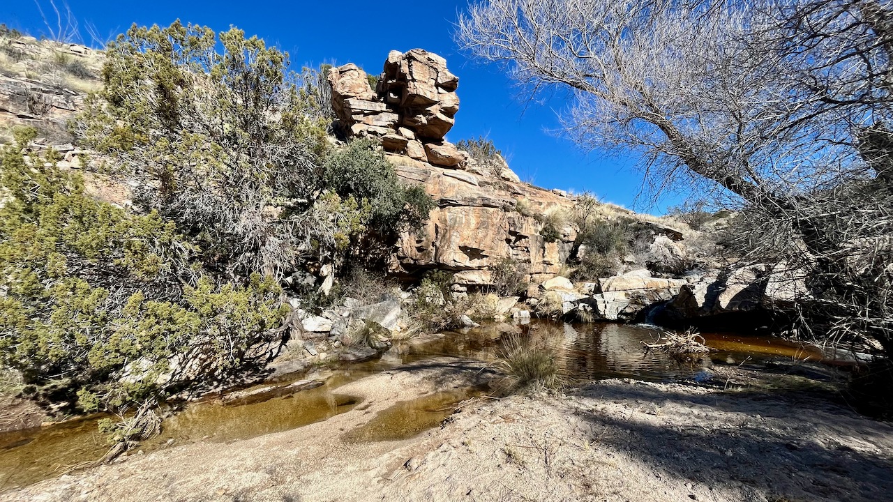
This is a great lunch spot, as folks have known for over a thousand years.


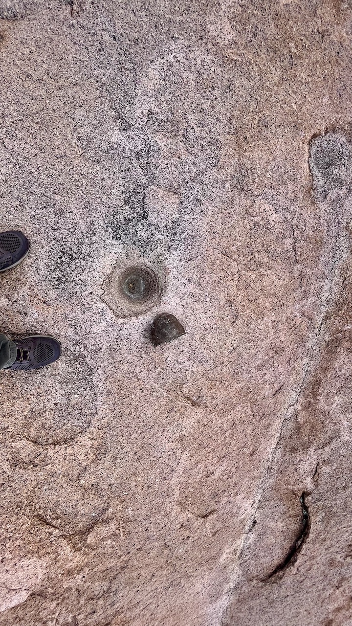
Mogollon and later Apache kitchen. Notice the grain grinding mortars in the foreground boulder.


Petroglyphs from the pre-historic Mogollon people, 1,000 CE. It is thought the drawings were later augmented by Apache visitors.


Another mortar.


Hugh Norris to Wasson Peak

After Saturday's epic twenty mile hiking event, I needed something a little shorter to end my season. Having already established a tradi...